Messages List
Topics List
Photos List
Files List
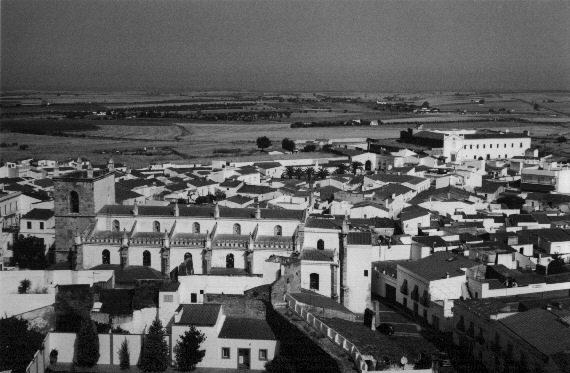
- Olivenza [By: oliventino1297 on Jan 01, 2006 @ 22:50]
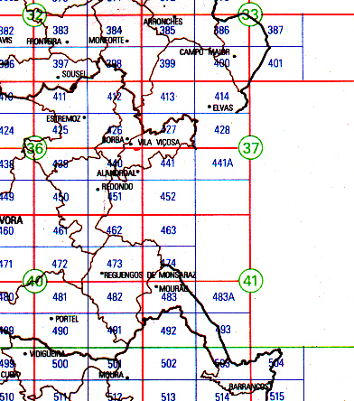
The Olivença/Olivenza Border
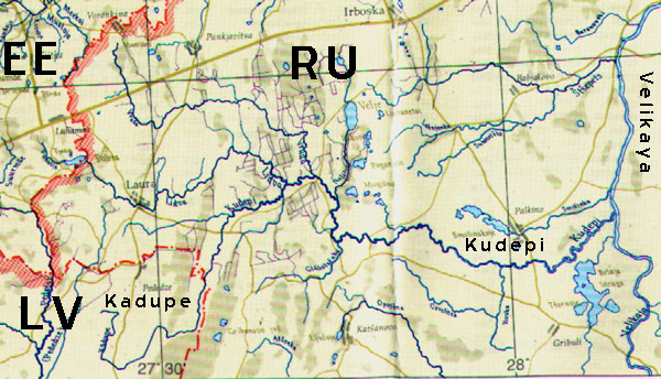
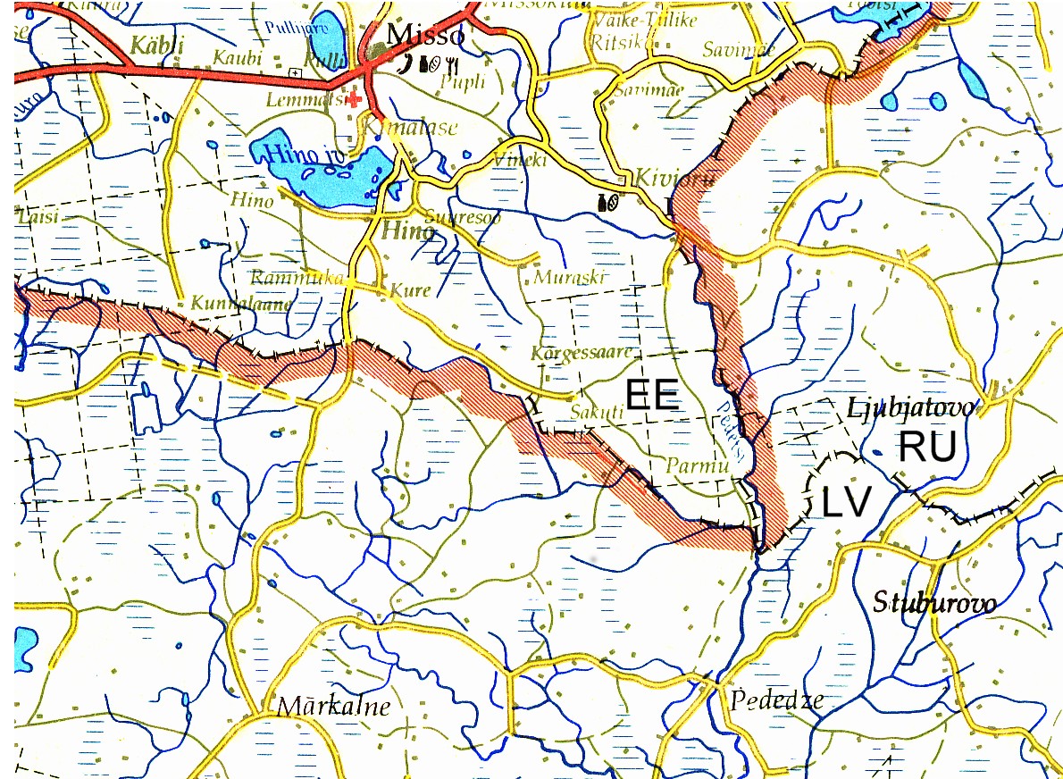
- EE-LV-RU [By: joostik on Oct 18, 2003 @ 17:54]
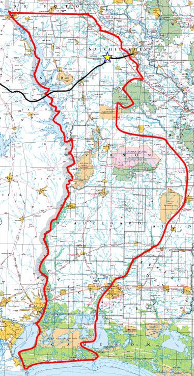
- mexico [By: jseelige on Jun 07, 2003 @ 23:41]
borders of mexico
- crop0006.jpg [By: jseelige on Jun 08, 2003 @ 00:21]
rio grande seen looking west from International Bridge I
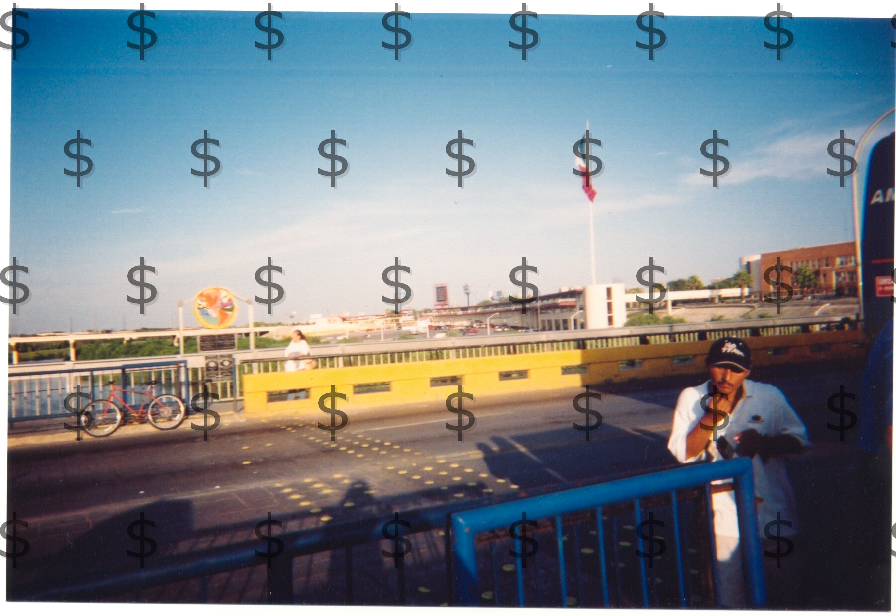
- crop0005.jpg [By: jseelige on Jun 08, 2003 @ 00:18]
from Int. Bridge I, facing SE, Int. Bridge II and CIETV seen in distance
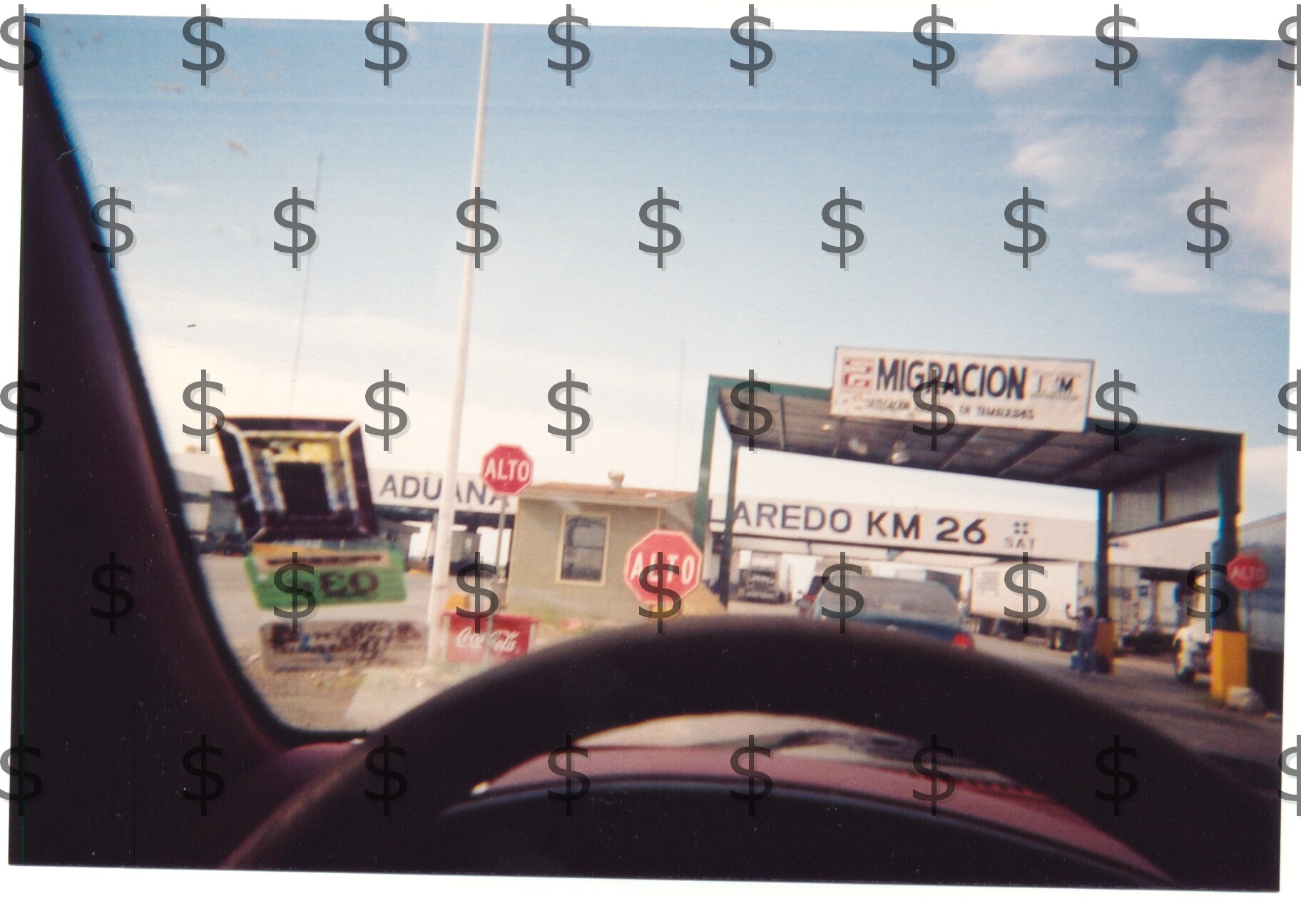
- crop0004.jpg [By: jseelige on Jun 08, 2003 @ 00:10]
Aduna checkpoint 26 km south of Laredo
- crop0003.jpg [By: jseelige on Jun 08, 2003 @ 00:01]
Bienvenidos a (Welcome to) Nuevo Leon
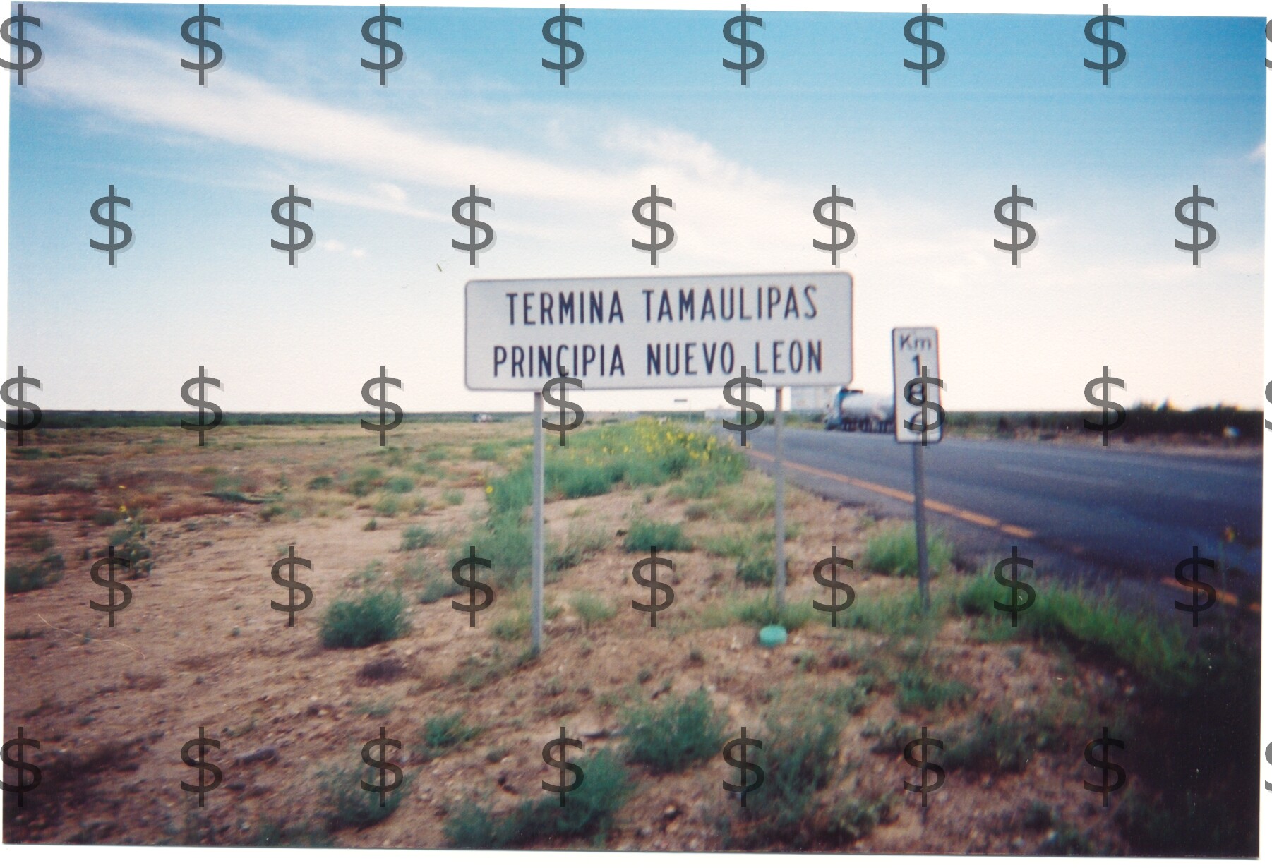
- crop0002.jpg [By: jseelige on Jun 07, 2003 @ 23:57]
termina tamaulipas principia nuevo leon
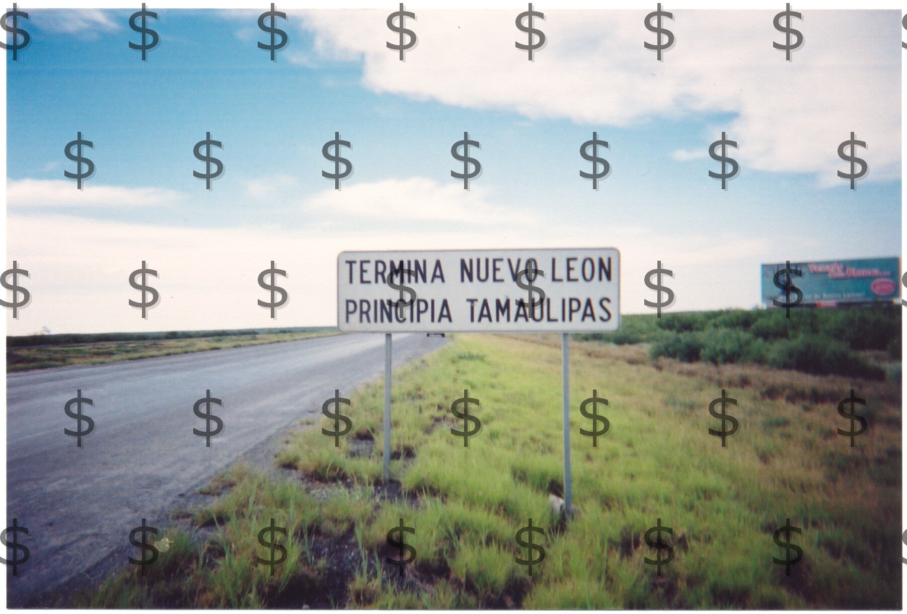
- crop0001.jpg [By: jseelige on Jun 07, 2003 @ 23:49]
termina nuevo leon principia tamaulipas
- US CANADA BORDER SIGNS [By: averillhecht on Oct 24, 2002 @ 02:30]
- athu [By: jesniel on Oct 04, 2001 @ 05:01]
Austrian-Hungarian border
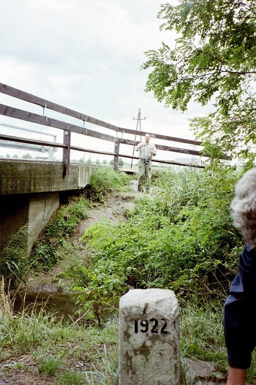
- Imm026.jpg [By: jesniel on Oct 04, 2001 @ 05:07]
Bridge at triangle salient at ATHU
- imm025.jpg [By: jesniel on Oct 04, 2001 @ 05:05]
Fran at triangle salient at ATHU
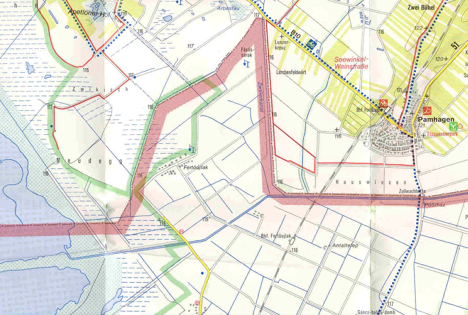
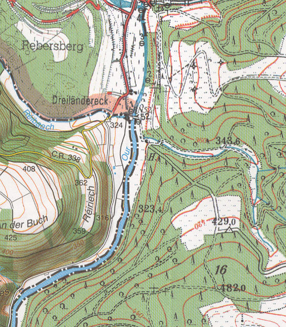
- pamhagen.jpg [By: jesniel on Oct 04, 2001 @ 05:04]
Map of triangle salient at Pamhagen, AT
- delu [By: jesniel on Jul 22, 2001 @ 11:49]
Files related to German-Luxembourg border including tripoints with neigbours
- DEFRLUBEDELU.PDF [By: jesniel on Jun 29, 2004 @ 20:04]
DEFRLU BEDELU
- BorderPointemail.doc [By: jesniel on Jul 22, 2001 @ 12:05]
Several tp pics, including areal shot and 1:10000 tp map of befrlu
- bedelu.jpg [By: jesniel on Jul 22, 2001 @ 11:59]
Map of bedelu tripoint area 1:20000
- defrlu.jpg [By: jesniel on Jul 22, 2001 @ 11:58]
Map of defrlu tripoint area 1:20000
- dedelulu.jpg [By: jesniel on Jul 22, 2001 @ 11:57]
Map of binational tripoints af Vianden 1:20000
- DELU.PDF [By: jesniel on Jul 22, 2001 @ 11:55]
Wolfgang's doc on DELU including ariel shots and 1:10000 maps
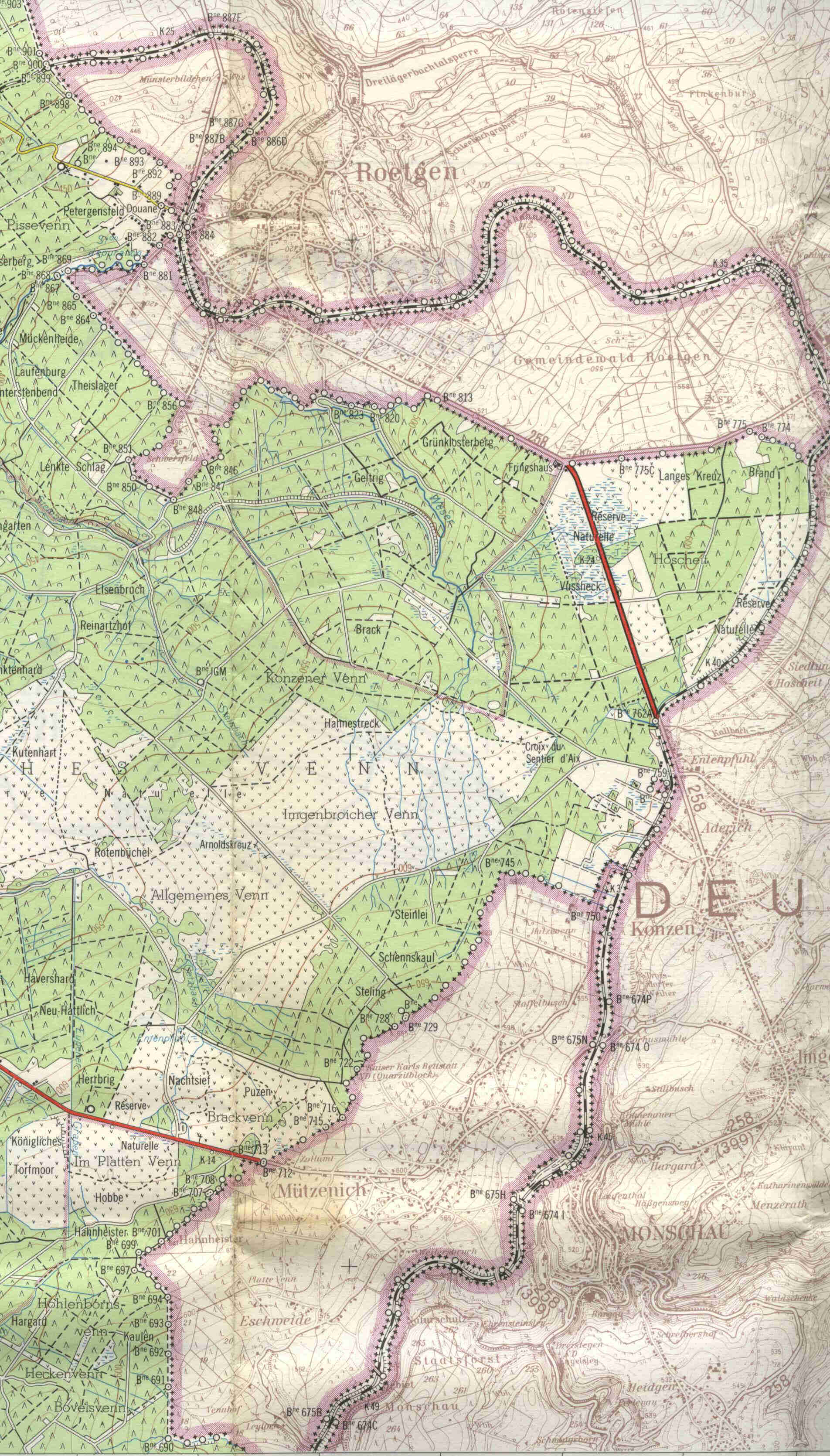
- Vennbahn enclave boundaries.xls [By: amcirclevp on Aug 09, 2006 @ 09:04]
Boundary data for the smallest Vennbahn enclave: turning points, area, perimeter.
- GSEEBEitinerary5.doc [By: mafiapetedk on Nov 17, 2004 @ 22:21]
Itinerary for 2005's border expedition
- BP.Classes.txt [By: mikekaufman79 on Jul 22, 2004 @ 05:05]
Multipointing Classifications
- neutral.jpg [By: lowellgmcmanus on Jun 05, 2004 @ 21:24]
de facto Neutral Ground, ESUS, 1806-1819
- Alexandria-DC.txt [By: mikekaufman79 on Dec 29, 2003 @ 23:36]
these 2 messages (I lost the #'s awhile ago) are a good reference to Alexandria and DC issues
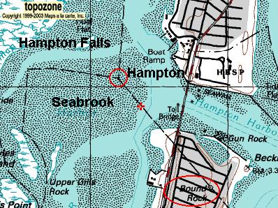
- BR.jpg [By: mikekaufman79 on Nov 16, 2003 @ 20:04]
Bound Rock, NH
- kudepi.JPG [By: joostik on Oct 03, 2003 @ 20:07]
Kudepi river EELVRU
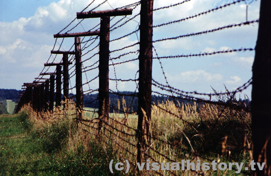
- curtain03.jpg [By: joseph_h001 on Sep 25, 2003 @ 14:59]
last remains from the former iron curtain at the town of Cikov, CZ
- europe.zip [By: granthutchison on Sep 02, 2003 @ 00:15]
Coordinates of all European boundaries, extracted from WVS and WDB datasets
- asia.zip [By: granthutchison on Sep 02, 2003 @ 00:14]
Coordinates of all Asian borders, extracted from WVS and WDB datasets
- americas.zip [By: granthutchison on Sep 02, 2003 @ 00:12]
Coordinates of all N, central and S American borders, extracted from WVS and WDB
- africa.zip [By: granthutchison on Sep 02, 2003 @ 00:11]
Coordinates of all African borders, extracted from WVS and WDB datasets
- Tripoints in Europerecord.doc [By: mafiapetedk on Jul 27, 2003 @ 11:38]
stats on Europ. tripoints
- BPlogo.gif [By: wjhanrahan on Apr 16, 2003 @ 19:08]
BP logo GIF file
- TEX-MEX Tugofwar.pdf [By: lnadybal on Apr 07, 2003 @ 14:29]
Stuck in the river
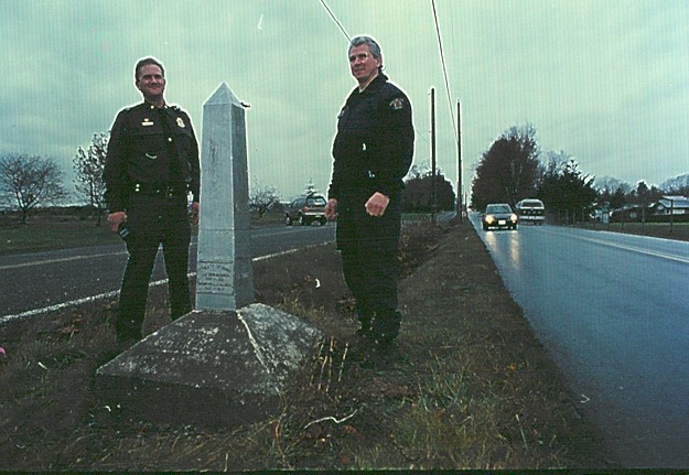
- 12 used in mag.jpg [By: averillhecht on Mar 10, 2003 @ 02:59]
US-Canada Border Guards on Zero Ave, BC/Boundry Rd, Washington.
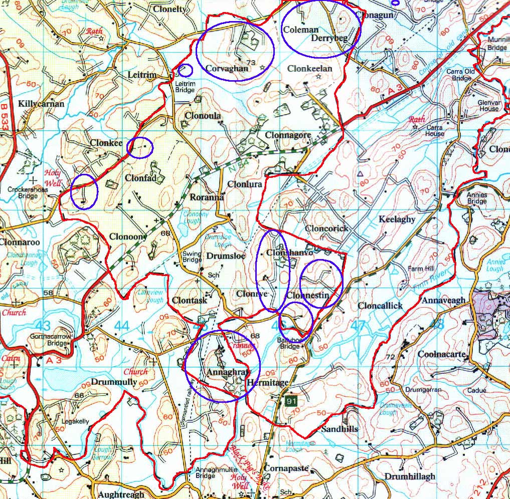
- IRL-NIRL-marked.jpg [By: max23568 on Jan 27, 2003 @ 15:14]
Border Ireland - Northern Ireland 1:50 000 Map Nr.27 (as noticed by Brendan) with pene-enklave-situations marked
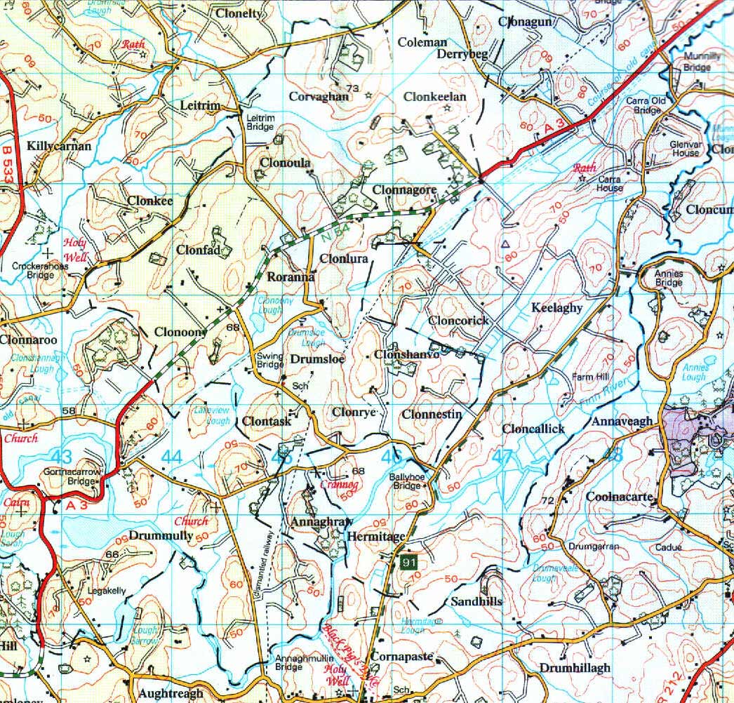
- IRL-NIRL.jpg [By: max23568 on Jan 27, 2003 @ 15:07]
Border Ireland - Northern Ireland 1:50 000 Map Nr.27 (as noticed by Brendan)
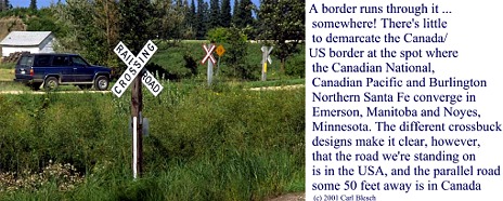
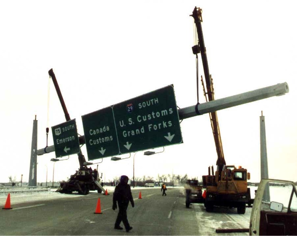
- signbrdg4.jpg [By: averillhecht on Oct 04, 2002 @ 04:03]
in Emerson, Man. off the net
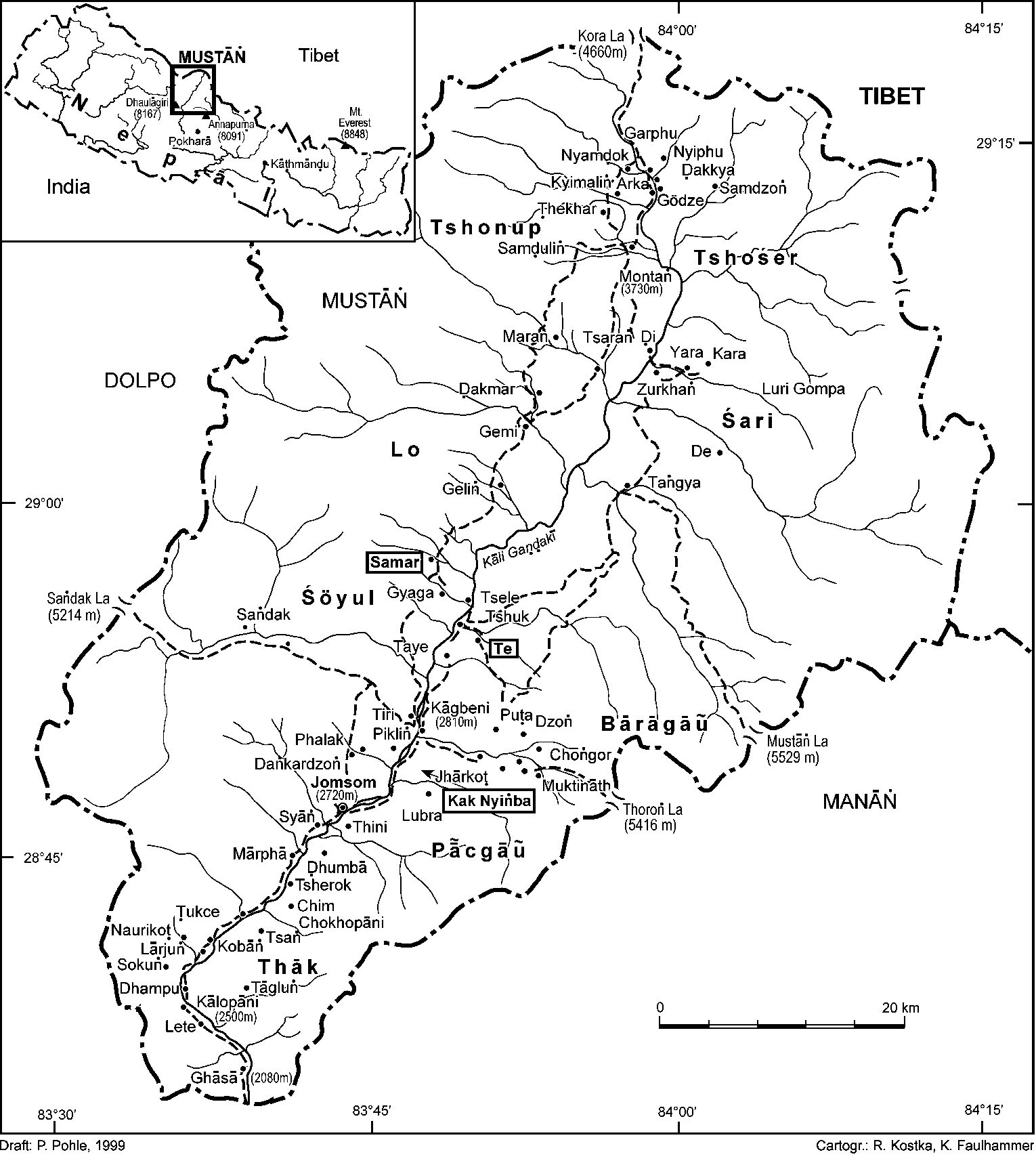
- Map of Mustang.gif [By: hermanngoe on Jul 30, 2002 @ 23:30]
Detailed map of Mustang (a semi-autonomous kingdom in northern Nepal)
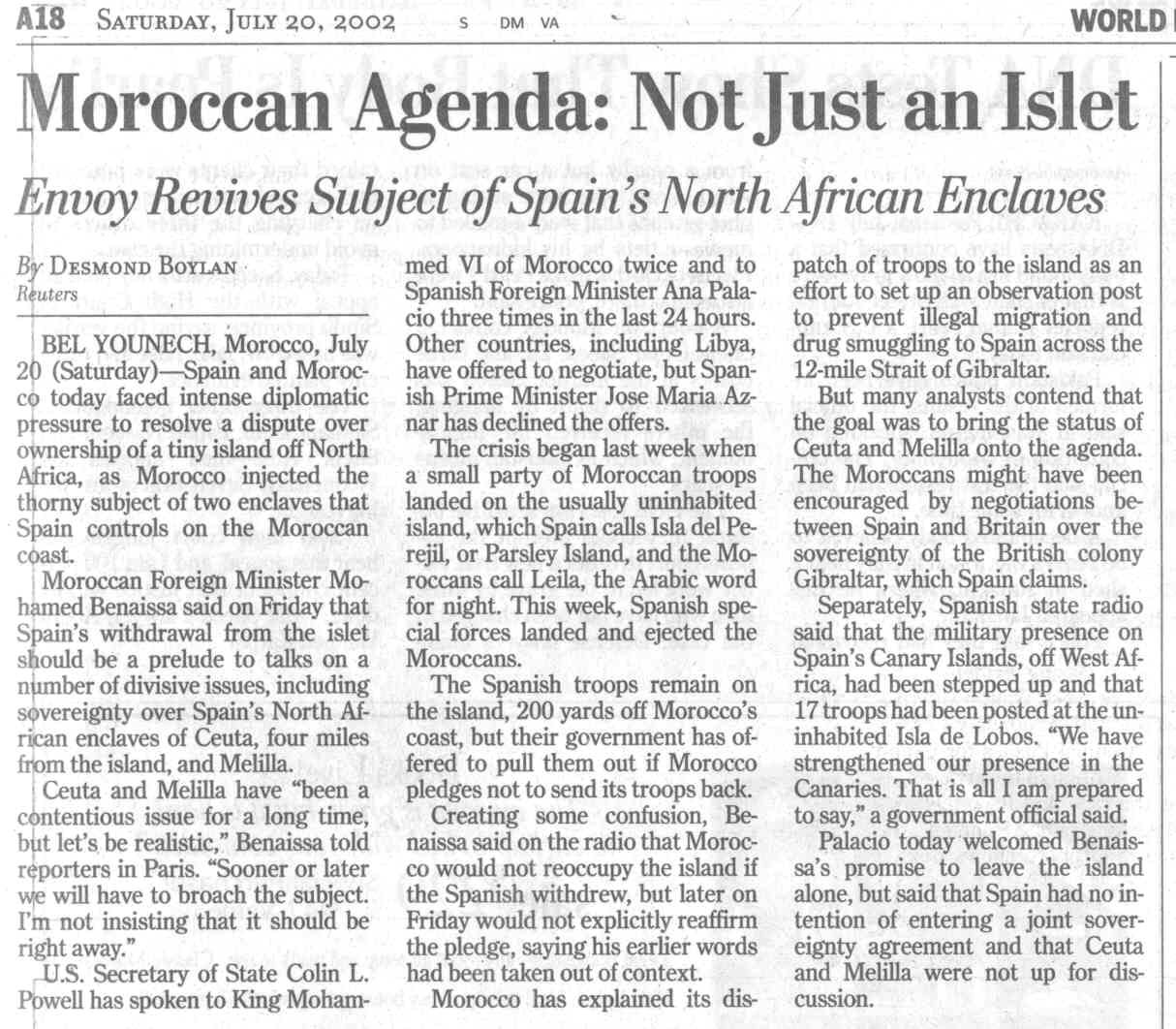
- morocco-islet-invasion washpost 20Jul02.jpg [By: lnadybal on Jul 20, 2002 @ 18:10]
WashPost 20Jul02 Article re: Morocco invasion of Islet
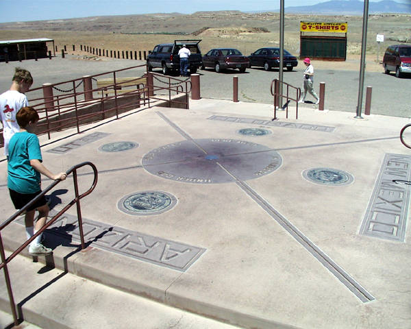
- fourcorn.jpg [By: zoommedix on May 04, 2002 @ 06:47]
- Everyone's Land borders.doc [By: granthutchison on Apr 30, 2002 @ 11:01]
A description of the borders of Everyone's Land
- International Boundaries.xls [By: granthutchison on Apr 16, 2002 @ 22:31]
World boundary survey at the EEZ level
- Foreign Parts.doc [By: granthutchison on Apr 14, 2002 @ 14:24]
Wanderlust article on enclaves
- 11-11.jpg [By: bjbutlerus on Feb 20, 2002 @ 02:15]
11:11 11/11/72
- belgmap1-50k-vennb.jpg [By: lnadybal on Jan 28, 2002 @ 01:42]
Vennbahn - Belgian Govt Map
- parsell.pdf [By: bjbutlerus on Jan 21, 2002 @ 15:43]
Tristate Corners in the United States by Jack Parsell
- Perfs & Frags.xls [By: granthutchison on Jan 20, 2002 @ 16:05]
World survey of countries that are perforated or fragmented at the 200nm EEZ level
- befrlu.jpg [By: jesniel on Oct 25, 2001 @ 18:46]
BEFRLU 1:10000
- Highseas.doc [By: granthutchison on Oct 23, 2001 @ 18:33]
World survey of areas of high sea enclaved by EEZs
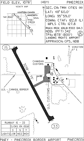
- pinecree.gif [By: exfed2002 on Oct 05, 2001 @ 16:22]
MN Airport Directory Page for Pinecreek Airport
- Concise Country Codes.xls [By: granthutchison on Oct 02, 2001 @ 16:51]
A table of the various alphanumeric codes used to identify the countries of the world
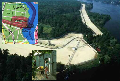
- The door & path.jpg [By: lnadybal on Sep 19, 2001 @ 03:24]
Montage - Aerial view W Berlin door and pathways to exclaves Erlengrund & Fichtewiese. A plot owner would ring the door to alert the DDR watchtower, and have the guard open the door through the Wall so that the visitor could walk the pathways to one or the other of the exclaves.
- Islands.doc [By: granthutchison on Aug 15, 2001 @ 22:12]
World survey of EEZ islands in the high seas
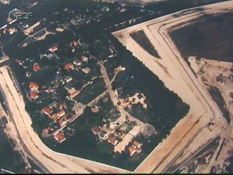
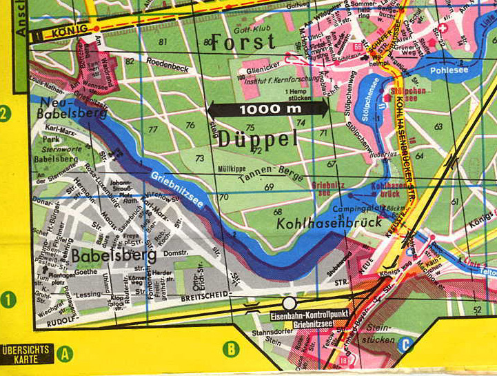
- steinstuecken.jpg [By: webernhard on Aug 07, 2001 @ 16:09]
TV-Photo of the enclave Steinstücken
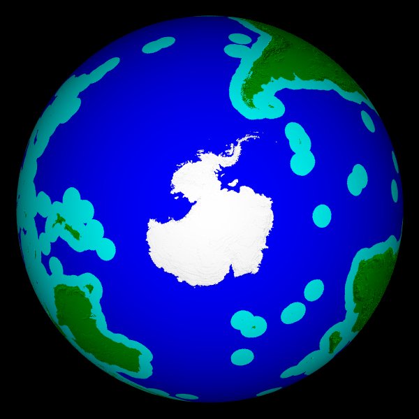
- EEZs.jpg [By: granthutchison on Aug 03, 2001 @ 22:10]
Everyone's Land, south polar
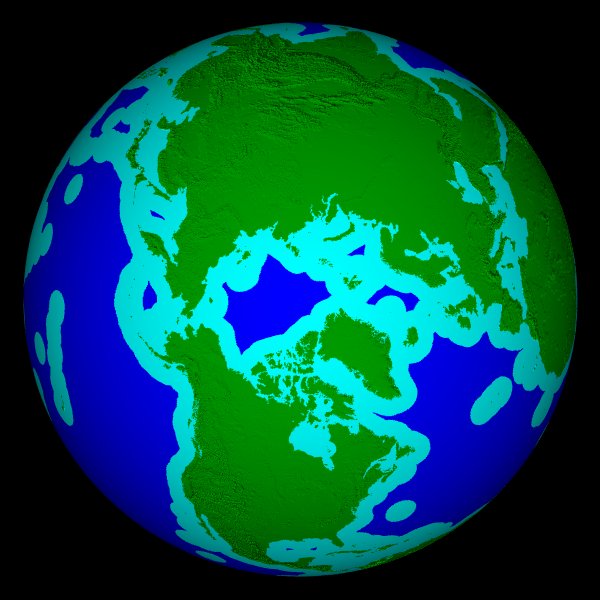
- EEZn.jpg [By: granthutchison on Aug 03, 2001 @ 22:09]
Everyone's Land, north polar
- EEZ270.jpg [By: granthutchison on Aug 03, 2001 @ 22:08]
Everyone's Land, 90 west
- EEZ180.jpg [By: granthutchison on Aug 03, 2001 @ 22:07]
Everyone's Land, longitude 180
- EEZ090.jpg [By: granthutchison on Aug 03, 2001 @ 22:06]
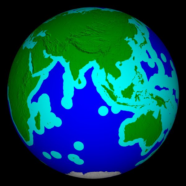
Everyone's Land, 90 east
- EEZ000.jpg [By: granthutchison on Aug 03, 2001 @ 22:05]
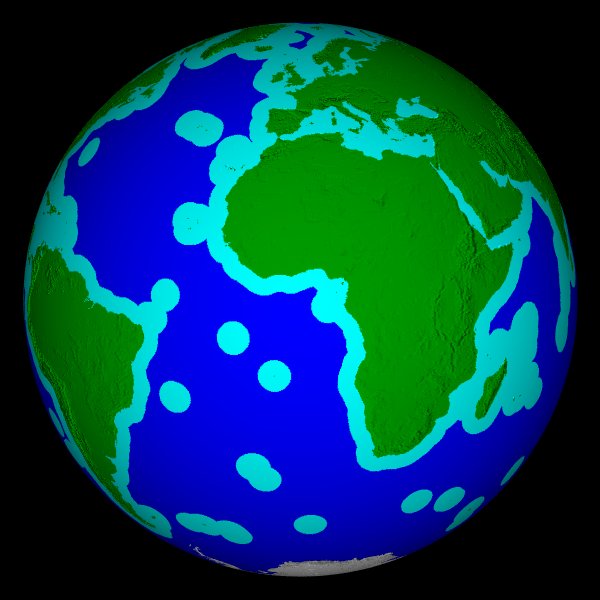
Everyone's Land, longitude 0
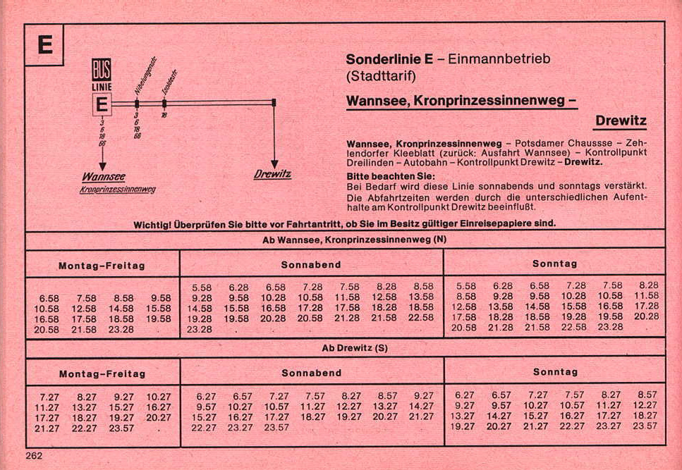
- etimetable.jpg [By: strataflorida on Jun 26, 2001 @ 13:01]
1977 BVG bus timetable page of Route E - Wannsee to Drewitz
- bvgmap.jpg [By: strataflorida on Jun 26, 2001 @ 12:54]
SW corner of Berlin public transport map, 1977
- falkberlin2.jpg [By: strataflorida on Jun 25, 2001 @ 08:51]
Fichtewiese/Erlengrund (from FalkPlan Berlin, 1977)
- falkberlin1.jpg [By: strataflorida on Jun 25, 2001 @ 08:49]
Steinstücken (from FalkPlan Berlin, 1977)
- African boundaries-statistics.doc [By: mafiapetedk on Jun 20, 2001 @ 18:02]
Statistics on African boundaries by Peter Hering
- Boundaries in Asia-statistics.doc [By: mafiapetedk on Jun 20, 2001 @ 17:58]
Statistics on Asian boundaries: length,ranking,no. of neighbors
- Rockies.jpg [By: bumpa50_1999 on Jun 09, 2001 @ 02:44]
- Boundaries in The Americas.doc [By: bumpa50_1999 on Jun 04, 2001 @ 11:49]
Statistics on boundaries in the americas - furnished by Peter Hering
- European boundary statistics.doc [By: bumpa50_1999 on Jun 03, 2001 @ 18:13]
List of European boundaries indicating number of common boundaries, total length by country, etc. - Peter Hering
- Maritime zones.xls [By: granthutchison on May 15, 2001 @ 12:53]
Summary of CIA Factbook information on maritime territorial claims
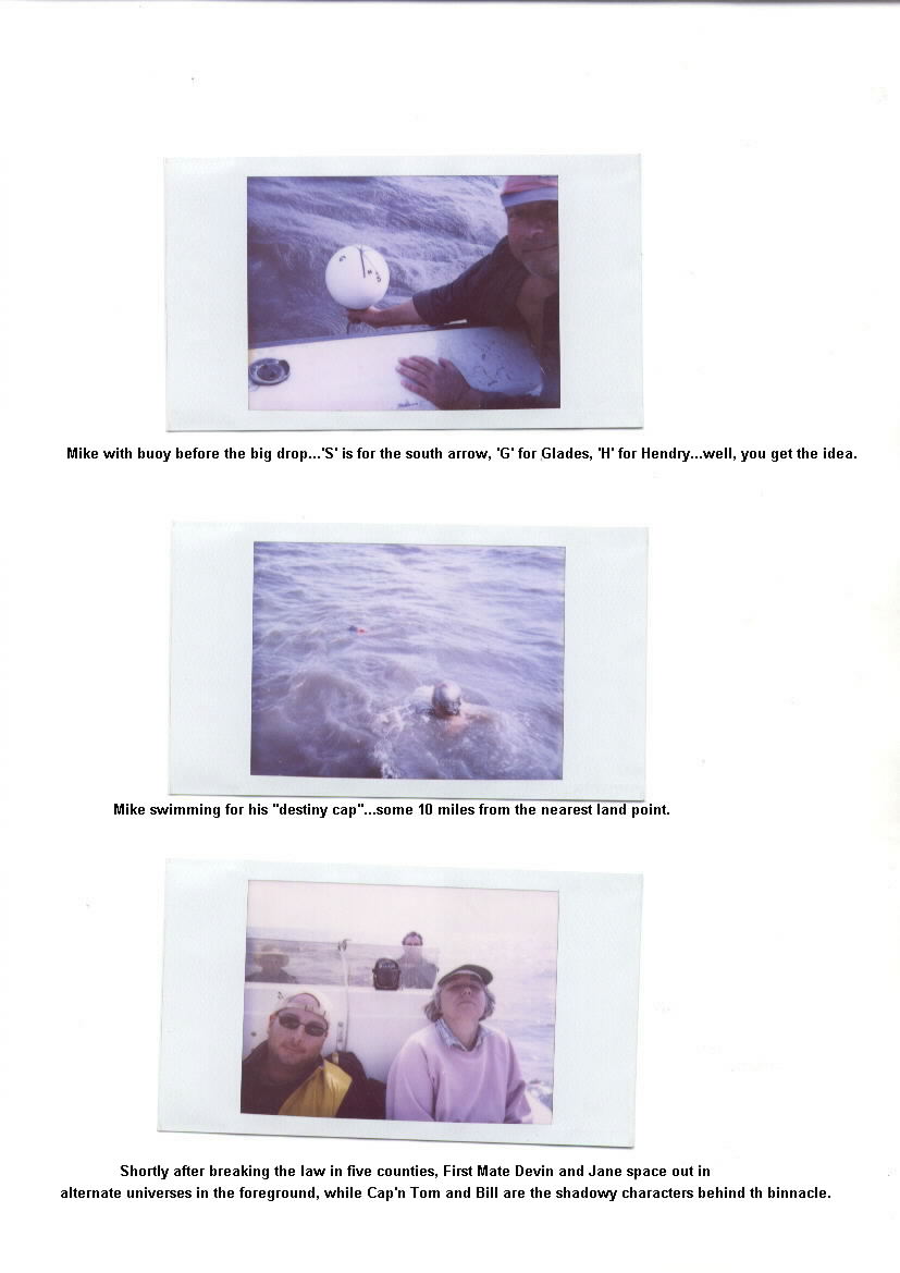
- okeechobee-3.jpg [By: bumpa50_1999 on Feb 12, 2001 @ 22:34]
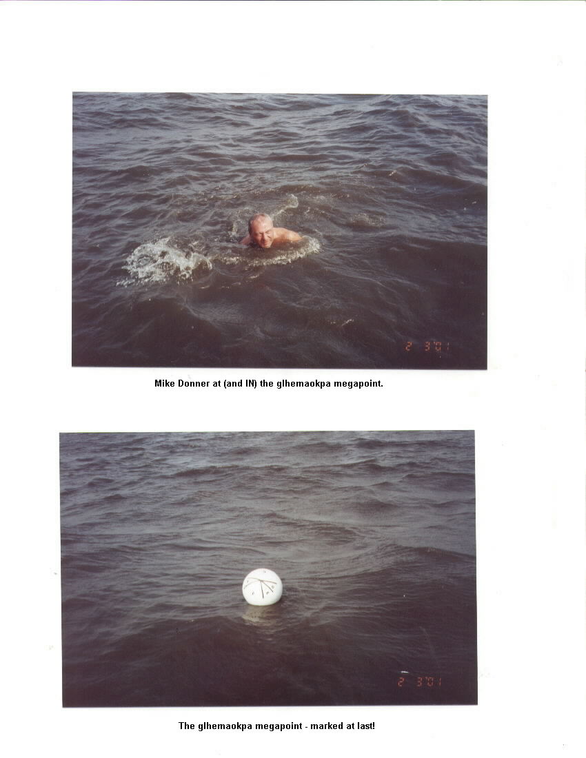
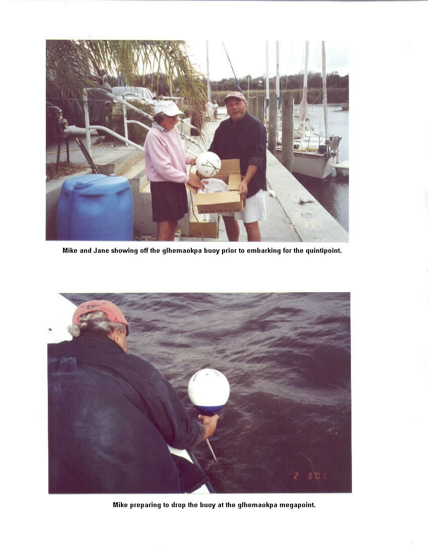
Lake Okeechobee/glhemaokpa additional photos - 3
- okeechobee-2.jpg [By: bumpa50_1999 on Feb 12, 2001 @ 22:32]
Lake Okeechobee/glhemaokpa additional photos - 2
- okeechobee-1.jpg [By: bumpa50_1999 on Feb 12, 2001 @ 22:31]
Lake Okeechobee/glhemaokpa additional photos - 1
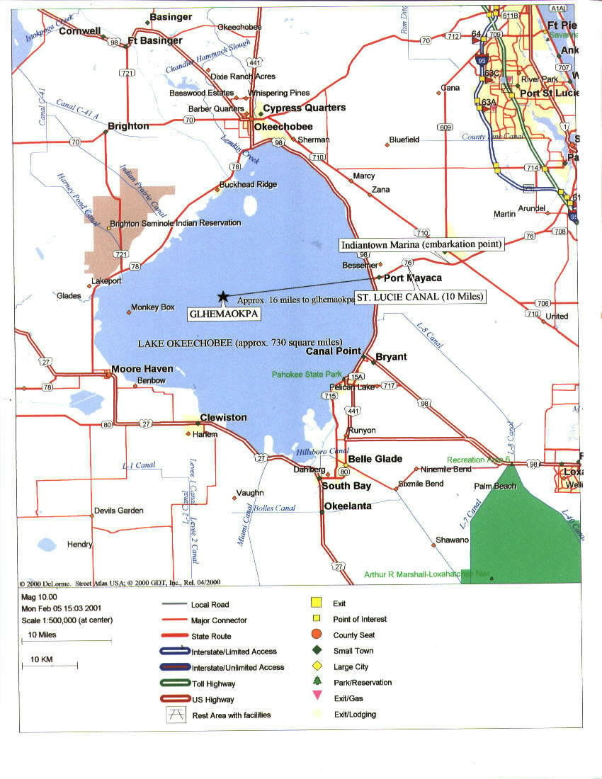
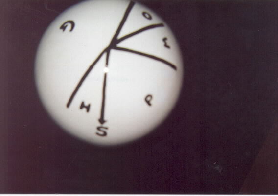
- glhemaokpa map.jpg [By: bumpa50_1999 on Feb 05, 2001 @ 20:18]
glhemaokpa wet megapoint map - Lake Okeechobee
- glhemaokpa-2.jpg [By: bumpa50_1999 on Feb 05, 2001 @ 20:16]
glhemaokpa wet megapoint photos-2
- glhemaokpa-1.jpg [By: bumpa50_1999 on Feb 05, 2001 @ 20:13]
glhemaokpa wet megapoint photos -1
- Okeechobee Marker.jpg [By: bumpa50_1999 on Jan 17, 2001 @ 21:24]
Photo of Okeechobee buoy quinticounty marker (photo and design by Mike Donner)
- BZMXborder.jpg [By: dougmurray85 on Nov 12, 2000 @ 21:44]
Mexico border w/ Belize
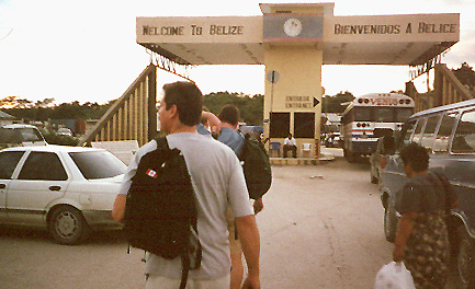
- belizeborder.jpg [By: dougmurray85 on Nov 12, 2000 @ 21:43]
Belize Border w/ Mexico
- laorospo.doc [By: bumpa50_1999 on Aug 28, 2000 @ 12:49]
laorospo: The Mystery of the Blue Dot
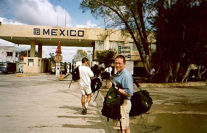
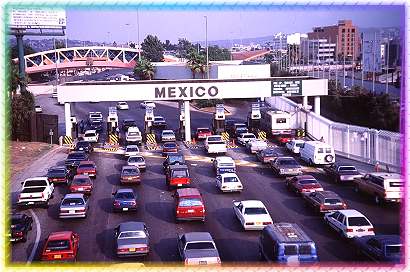
- Tijuana crossing.jpg [By: bumpa50_1999 on Jul 07, 2000 @ 19:24]
Tijuana border crossing
- Ireland-UK.PDF [By: prattson on Jun 14, 2000 @ 11:21]
Text of "Some Lessons from the 1924-25 Irish Boundary Commission" by Gerald Blake